Why switch
From ladders and guesswork to fly, measure, and share.
The old way
Valleys, dormers, step flashing: manual sketches and tape measures make it easy to miss a section or get the angles wrong.
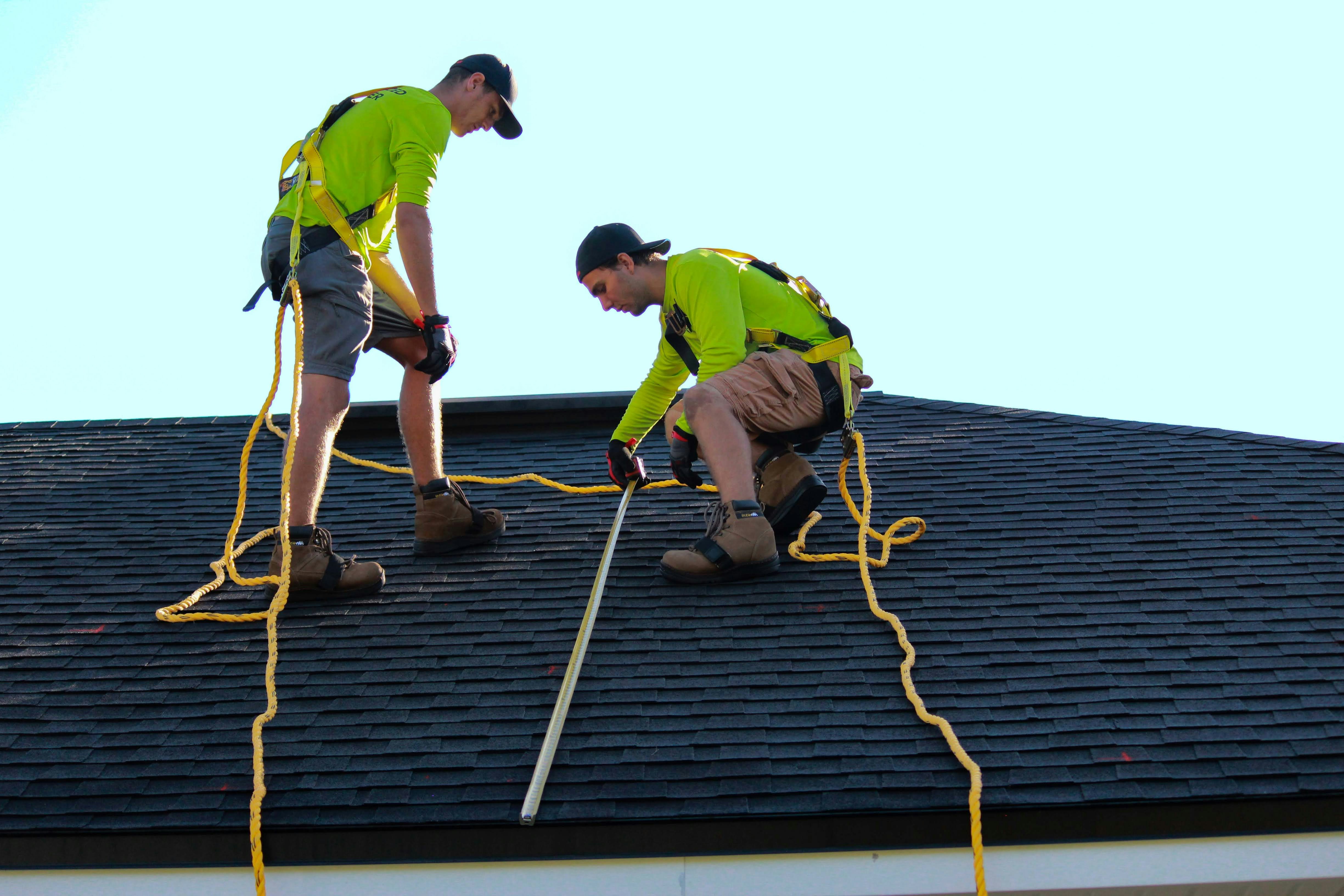
Climbing, measuring, sketching, then back to the office to turn it into a quote. One job can eat half a day.

One missed area or bad measurement and your quote is off. The fix comes out of your profit or your reputation.

Every trip onto the roof is a risk. One slip and you’re dealing with injury, downtime, and insurance.

The new way
Request aerial imagery with platform. No heavy setup; our team is there if you need a hand.
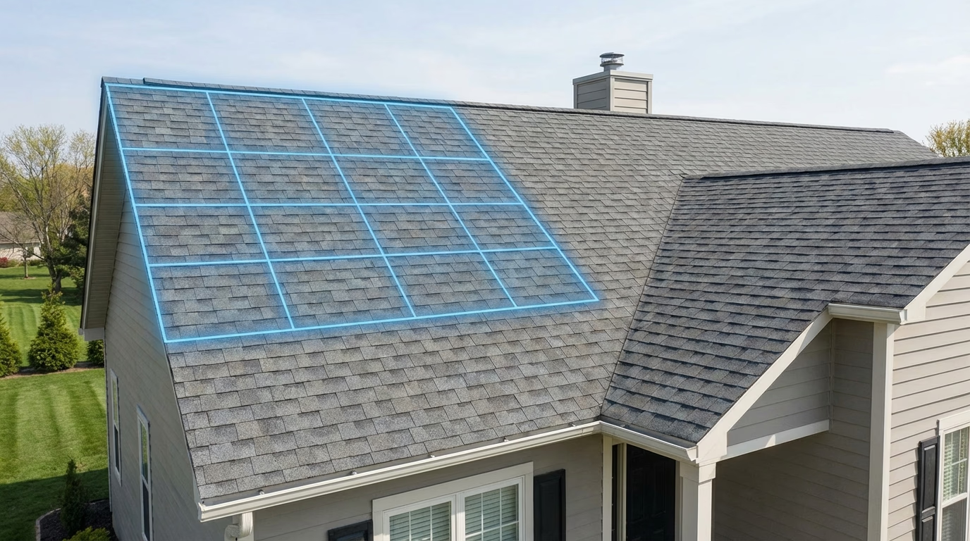
Capture the whole roof and site in a single pass. No callbacks for missing measurements.
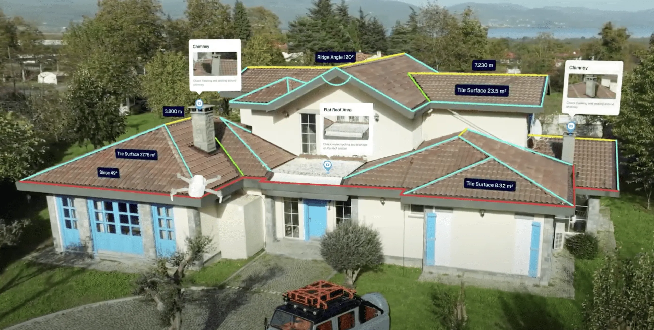
Clear roof and site data you can build designs and quotes from, with confidence.
No ladders, no walking on roofs. Measure everything from the ground and share reports with clients.
Process
Fly. Measure. Share. No ladders required.
Step 01
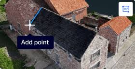
Place a request for high-resolution aerial imagery of the property directly through our platform.
Step 02
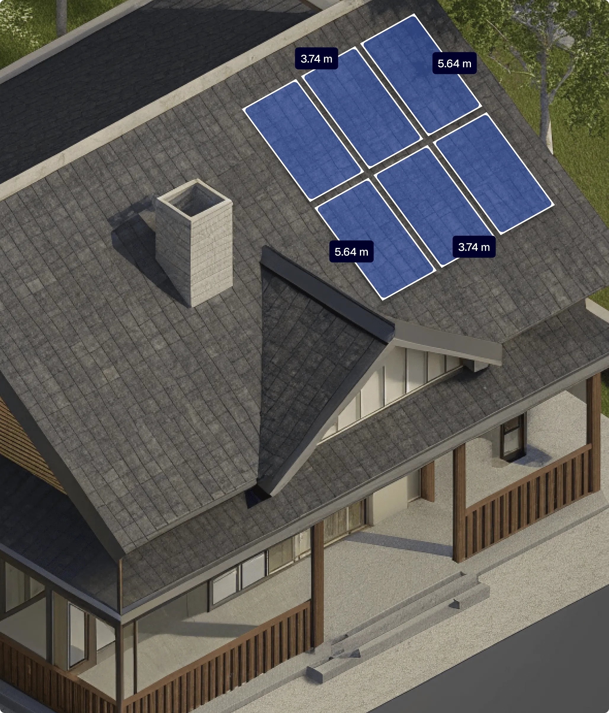
Our software automatically processes the captured imagery to extract precise roof measurements and condition data
Step 03
Send designs, reports, and quotes to your team and clients so everyone stays on the same page.
Try roof mapping free for 30 days with core features and support so you can fly, measure, and quote without commitment.
Fly your drone with our app or upload LiDAR data. Get roof and site models, then pull out the measurements you need to quote.
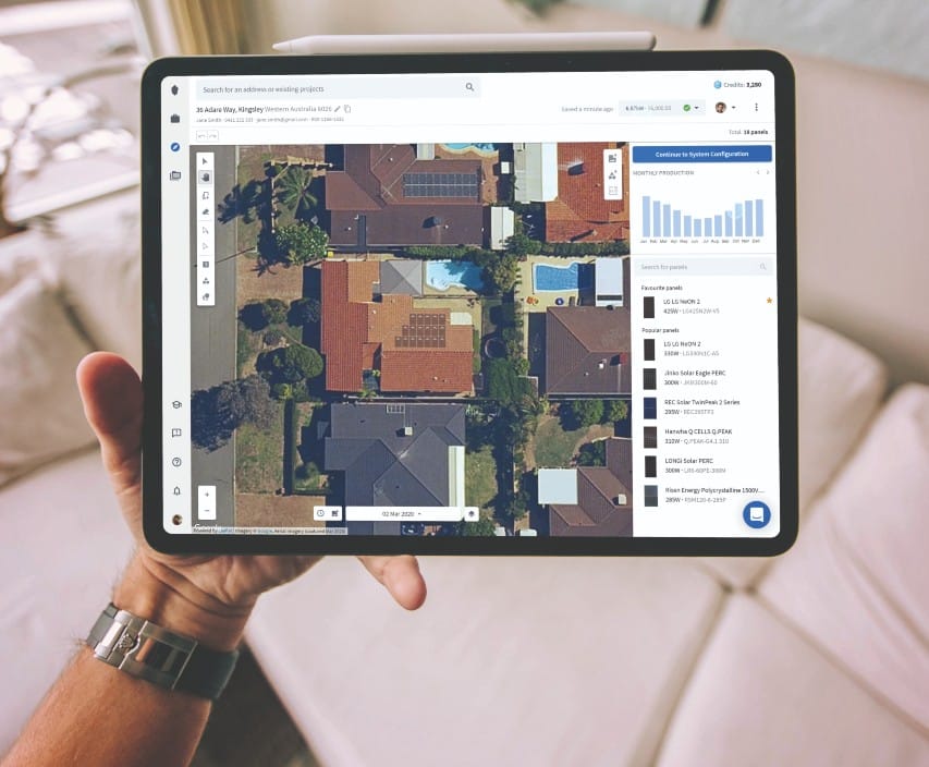
No heavy installs. Open it in any browser, on any device, and start measuring roofs from the ground.
Roof pitches, areas, edges: all in one place. Build designs and quotes, then share reports with your team and clients.
Testimonials
“We used to send guys up on roofs with tape measures. Now we fly once, get all the measurements we need, and quote the same day. No ladders, no callbacks.”
Sarah Chen
Operations Manager, Solar & Roofing Co.
“The numbers from the drone match what we see on site. We build our quotes on those measurements and our clients trust the reports. It’s made quoting faster and more accurate.”
James Okonkwo
Lead Surveyor, Construction & Survey Ltd.
“From flying the drone to sharing the report with the client, it’s one flow. We measure roofs and sites without setting foot on a ladder. Game changer for our team.”
Maria Santos
Director, Roofing & Restoration
FAQ
Use our app to autopilot your drone or fly manually. Capture your site, then process the data to get accurate measurements of roofs and terrain. You can also import LiDAR data for instant models without flying.
You can use any GPS-capable camera drone for capture, or upload existing aerial imagery and LiDAR data. The platform works in your browser; no heavy desktop software required.
Measurements are derived from your captured data and calibrated to your project. You get clear, auditable numbers you can use for quotes and designs without climbing or manual tape measures.
Yes. Share designs, reports, and quotations directly from the platform. Export and collaborate so your team and clients stay aligned without extra tools.
Yes. You can try the platform free for 30 days with access to core features and support. No credit card required to get started.
Trusted across industries
Energy Industry · Construction · Agriculture
Request a service or create an account and run your first AI task.