

Enabling Aerial Monitoring and Inspection
Transform aerial imagery into powerful insights with AI-driven monitoring, inspection and evaluation.
About Us
We are a global technology company specializing in AI-powered solutions that drive smarter, faster decision-making across three key sectors; oil and gas, construction and agriculture. By leveraging aerial imagery from drone or satellite, and Artificial Intelligence, we help industries safeguard assets, cut costs, and operate more efficiently.
Mission Statement
To transform asset monitoring through intelligent, automated detection of risk — powered by AI, drones and satellite data.
Vision Statement
To revolutionize how infrastructure is maintained— using AI and aerial intelligence to make our world safer, smarter, and more resilient.
What our software does
Asset Evaluation
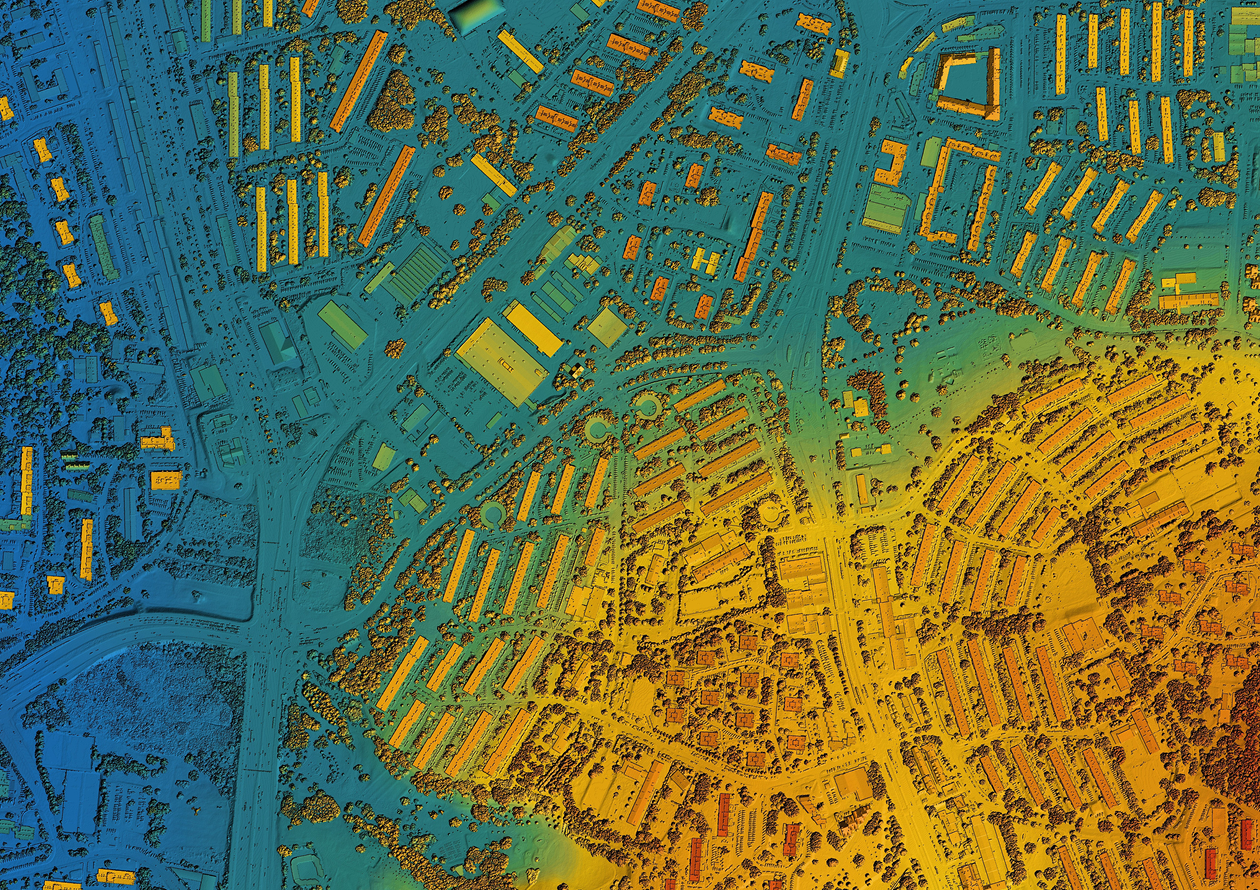
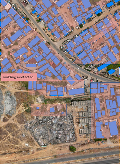
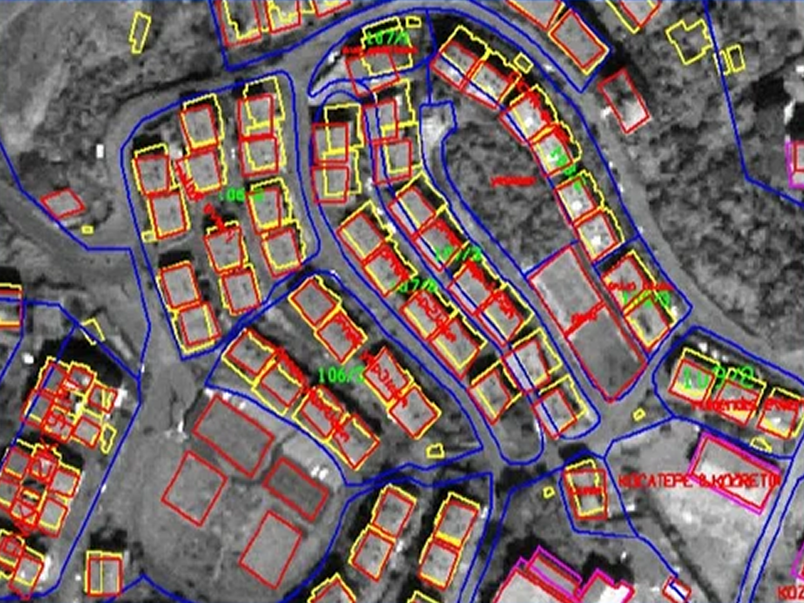
Our AI-powered tool converts physical or scanned maps into accurate, editable digital formats. It classifies features from geologic maps, engineering designs, and aerial imagery, adapting to different formats and eras thanks to training on a vast, diverse dataset. By recognizing patterns like line styles and polygon fills, it ensures high precision in feature extraction. The result is a digitization process that’s twice as fast as manual methods while maintaining accuracy and consistency.
Asset Monitoring
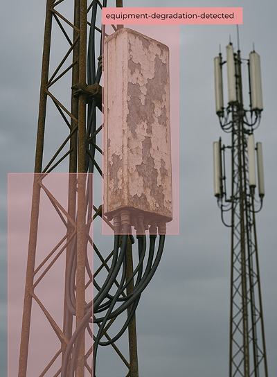
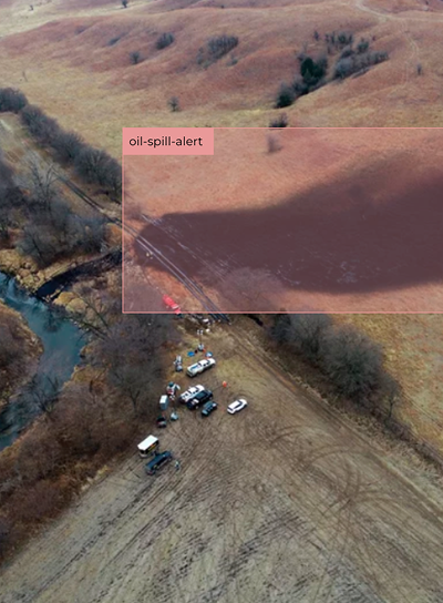
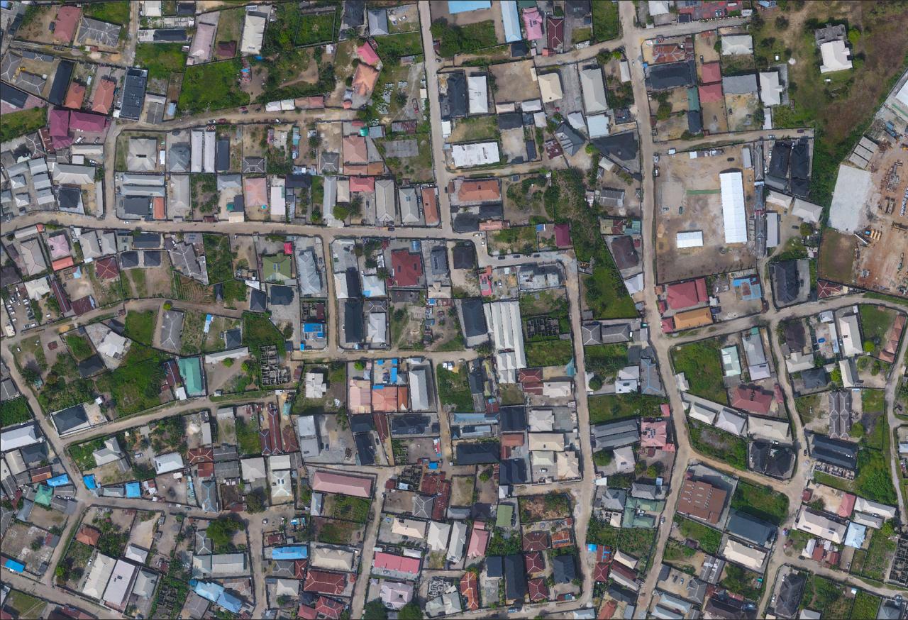
We use AI to continuously scan aerial imagery for signs of asset damage such as corrosion, cracks, or structural faults. The system analyzes data in real time, minimizing the need for manual inspections and ensuring rapid issue detection. FieldWatch also monitors changes over time, allowing operators to spot gradual degradation or unauthorized alterations. This improves maintenance scheduling, enhances safety standards, and reduces operational costs.
Asset Inspection
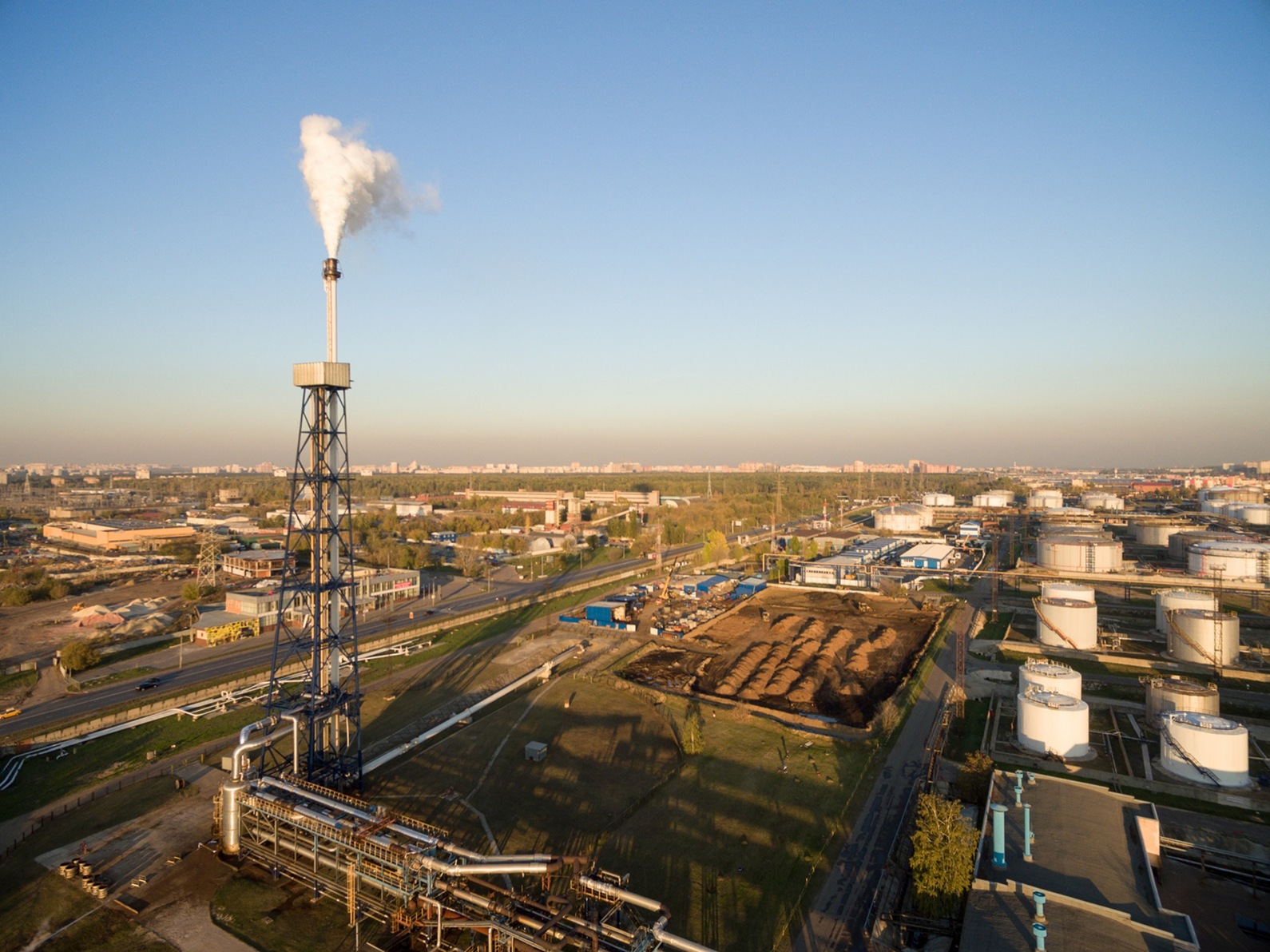
Our inspection feature leverages AI to analyze high-resolution aerial imagery for quick, accurate assessments across industries. FieldWatch identifies early signs of wear, structural damage, and even agricultural issues like crop disease. Advanced computer vision techniques enable proactive maintenance by flagging potential problems before they escalate. This reduces downtime, prevents costly failures, and ensures smoother operational performance.
Digitize Maps 2x Faster.
Efficiently extract and vectorize features from engineering designs, geologic maps, and aerial data.
Click the sign up button. Follow the simple sign-up steps.
Upload your aerial imagery or the coordinates of the area you want to analyze.
FieldWatch processes your uploaded imagery based on your selection and delivers a report with actionable insights.

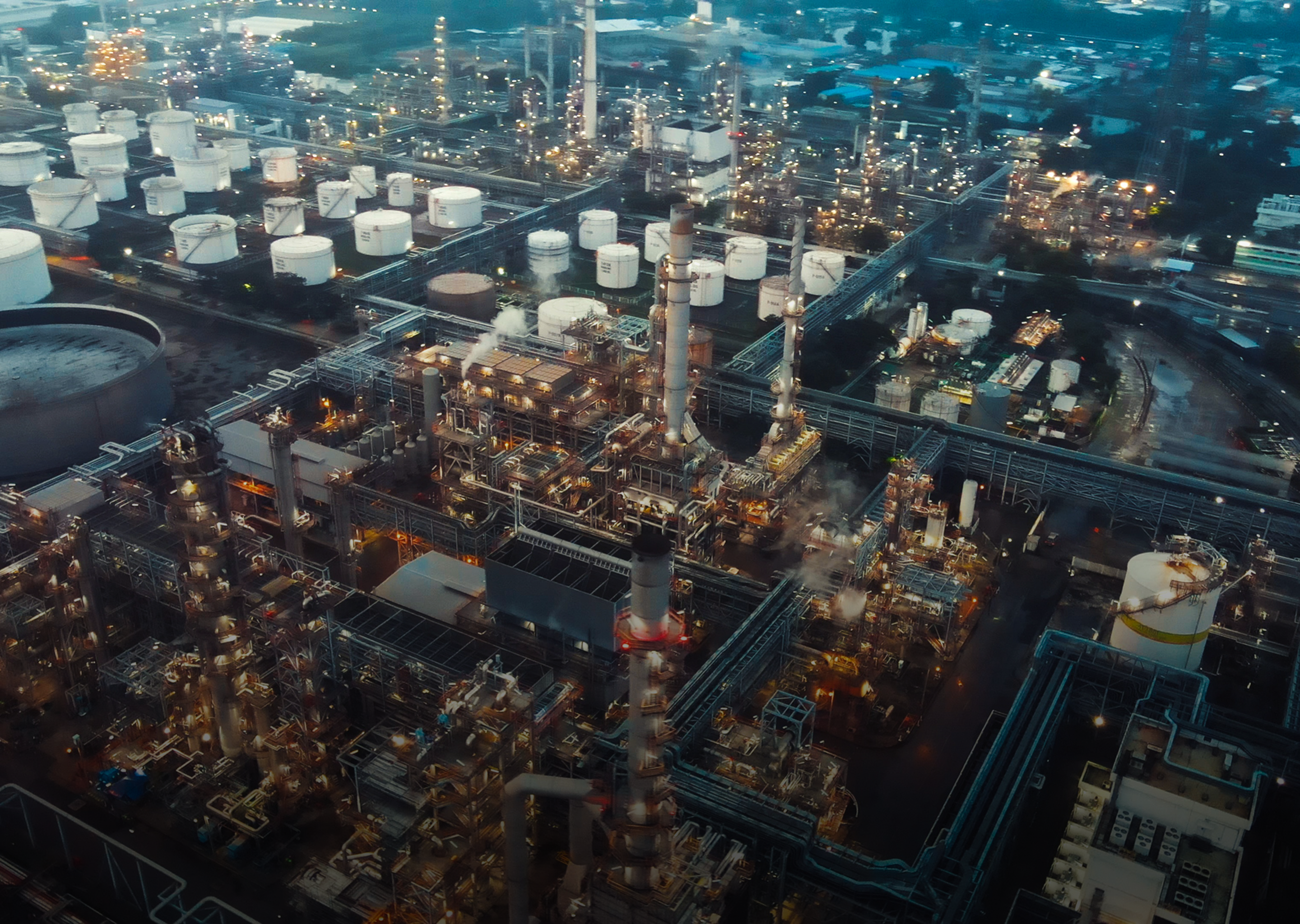
Oil and Gas
Construction
Agriculture